Guro District (Guro District)
The name Guro originates from the legend that nine (gu) old men (Korean: ro) enjoyed longevity in the district.
A digital industrial complex is located in Guro District. The Guro Digital Industrial Complex, which played a leading industrial role mainly with textile manufacturing, dressmaking and other labour-intensive industries in 1967, has been rapidly changed into an IT industrial complex. This complex played a pivotal role in the economic growth of the South Korea's development era, referred to as the "Miracle on the Han River", and also contributed 10 percent of national export in the 1970s.
Twenty-one percent of the total area of Guro District is a restricted zone to be used as a greenbelt with the only arboretum in Seoul. The zone is changing into a lively district as large labour-intensive factories are moving from the area and the council is developing what it terms its four zones.
An "e-government" system based on this hosted the international e-participation forum on February 7–9, 2007, with the participation of more than thirty-seven countries. The forum was launched with the theme "Promoting Democracy and Regional Development" and twenty-five mayors including André Santini (Issy-les-Moulineaux, France), Kevin Foy (Chapel Hill, US), Apirak Kosayothin (Bangkok, Thailand), Uvais Mohamed Emthiyas (Colombo, Sri Lanka), and world experts such as Dr William H. Dutton (Director of Oxford Internet Institute at the University of Oxford, UK) and Dr Ari-Veiko Anttiroiko (professor at the University of Tampere, Finland) participated in the forum. The Guro Declaration, adopted during the forum, aims to set up a portal site for e-government development and to establish a concrete project in order to bridge the digital divide among the world's cities. This practice has been recognised for providing a new important step in the development of e-democracy.
The e-participation forum was a key factor for Guro to play the leading role in bridging the digital divide among cities, to provide I.T. enterprises located in Guro Digital Industrial Complex the opportunity to launch into the international market, to improve its image and become a global leader to concrete e-democracy.
Map - Guro District (Guro District)
Map
Country - Mozambique
 |
 |
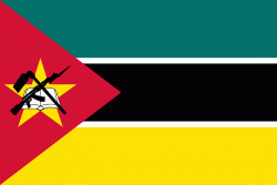
| Flag of Mozambique | |
Notably Northern Mozambique lies within the monsoon trade winds of the Indian Ocean and is frequentely affected by disruptive weather. Between the 7th and 11th centuries, a series of Swahili port towns developed on that area, which contributed to the development of a distinct Swahili culture and dialect. In the late medieval period, these towns were frequented by traders from Somalia, Ethiopia, Egypt, Arabia, Persia, and India.
Currency / Language
| ISO | Currency | Symbol | Significant figures |
|---|---|---|---|
| MZN | Mozambican metical | MT | 2 |
| ISO | Language |
|---|---|
| PT | Portuguese language |


